Building Footprints and Image Segmentation
Problem Statement
After consecutive days of heavy rainfall, the Mississippi River has peaked and began flooding the city of Guttenberg, Iowa. Unfortunately, many homes and business have been damaged by the rushing waters and are now underwater.
This model can be helpful in a situation such as:
- Damage assessment
- Navigation planning
- Rescue planning
Demonstration of Segmentation
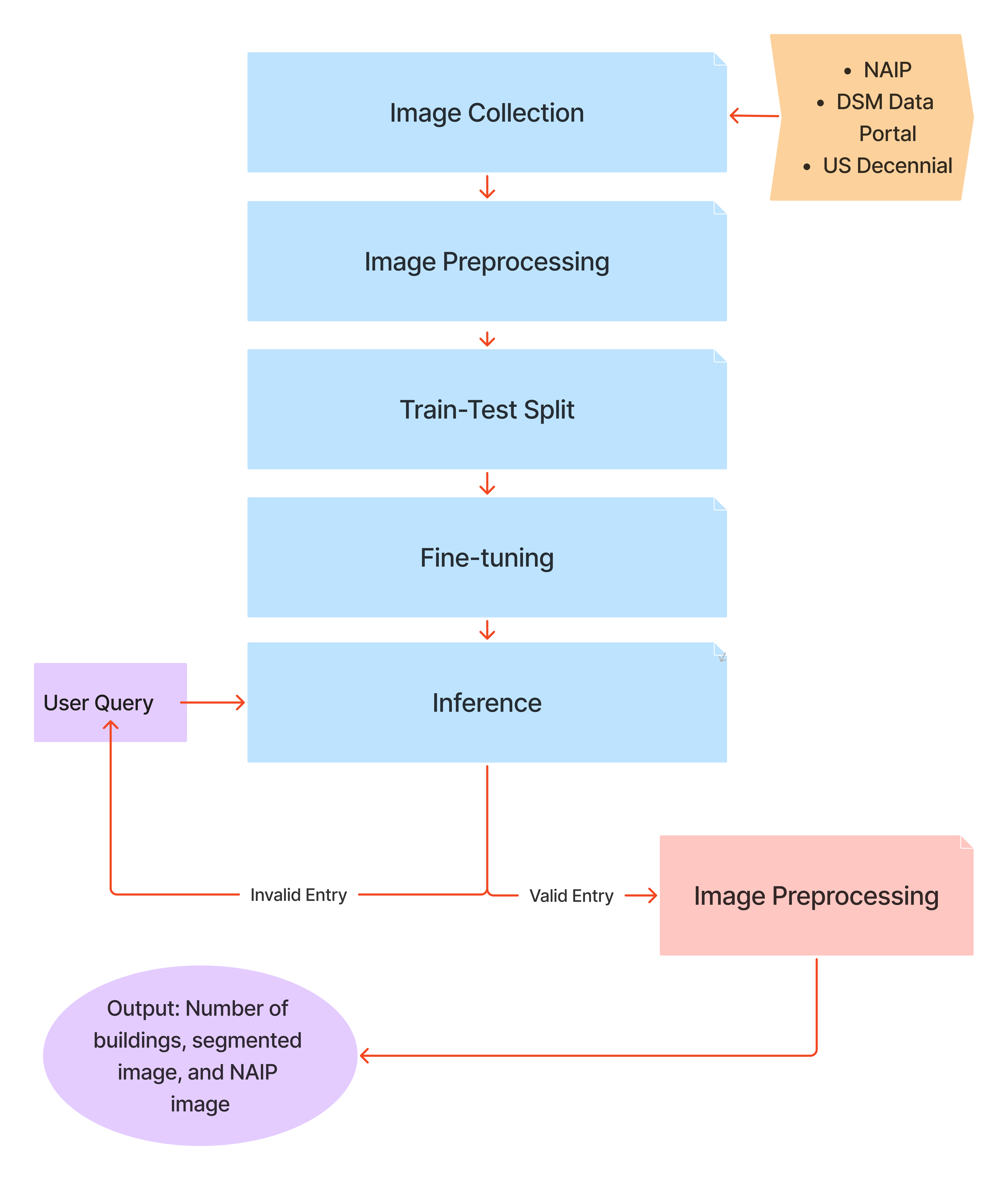
Aerial Imagery Model Flow
Model Performance
Strengths:
Homes and businesses outline
Identifies what previous data hasn’t
Can produce images statewide
Weaknesses:
Images with trees blocking buildings
Shadows within image
Improvements
- Expand model beyond census blocks
- Distinguish between homes and other buildings
- Expand model to more classifications (ex. flooded areas)
Why is it Important?
- Provides real-life visualization
- Develops understanding of the region
